Camping in James Peak Wilderness, Colorado
July 24, 2021 · 9 min read · travel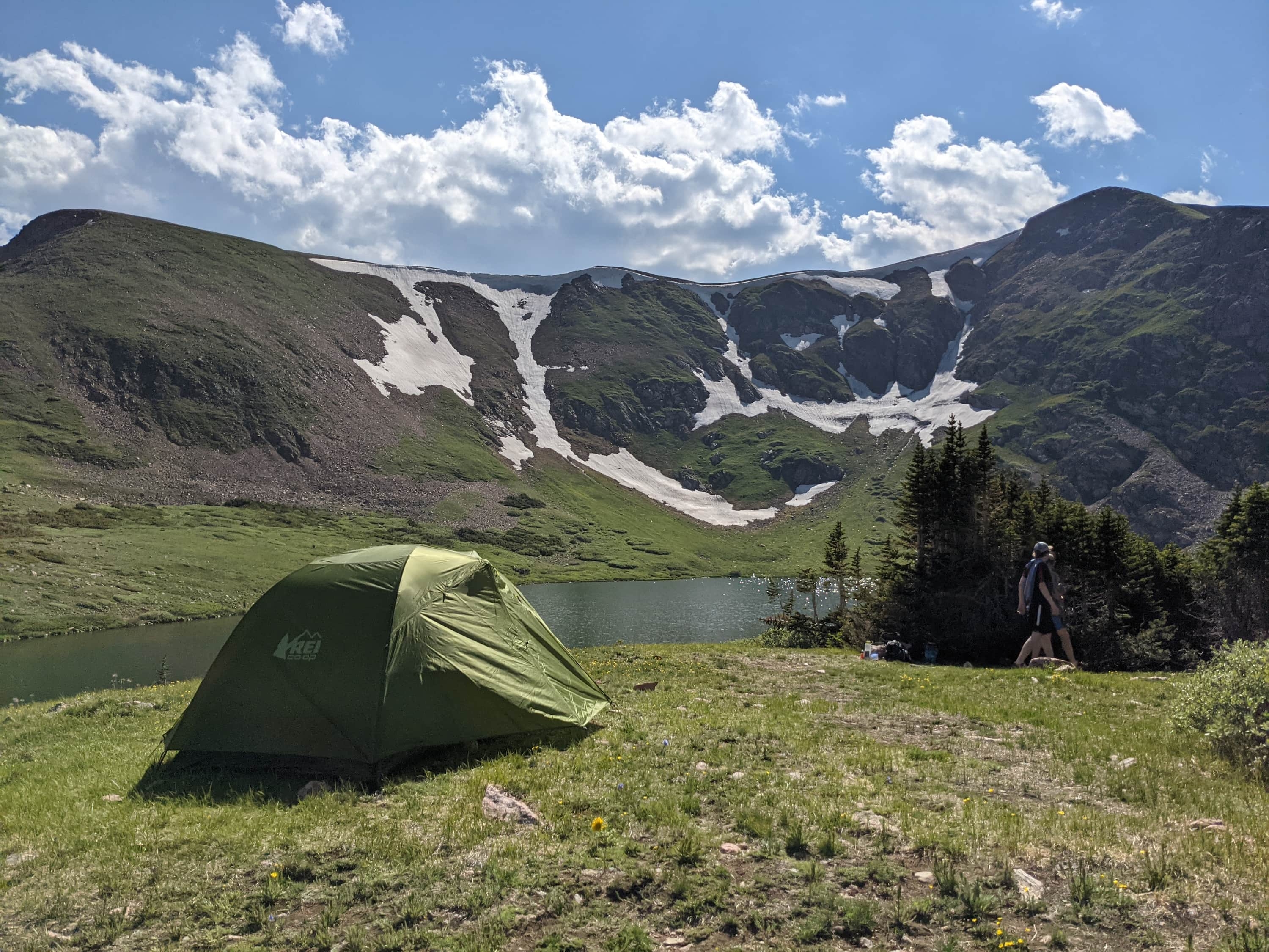
If you're looking to reconnect with nature, look no further than Colorado's pristine backcountry. Growing up, my family didn't spend much time in the mountains, so if you were to ask me a few years ago whether I preferred the beaches or the mountains, I would have said the beaches in a heartbeat. But now, having spent a few weeks exploring the mountains of the Centennial State, I feel that I have a newfound appreciation for it.
To top off our 4-week trip to Colorado this summer, we decided to spend a few days backcountry camping. Boasting four national parks, 11 national forests, and at least 40 more federal wilderness areas, there is no shortage of beautiful hikes and campsites in Colorado.
For us, we decided on James Peak Wilderness, a 17,000-acre wilderness area situated in the Arapaho and Roosevelt National Forests. To the north it borders the Indian Peaks Wilderness (another amazing place to hike!), and to the west is the Continental Divide. It's a great option for those based out of the Boulder area, as it's only about an hour west. Not gonna lie, I initially doubted how beautiful it would be considering it's less popular than the Indian Peaks, but I was happy to be proven wrong. The James Peak Wilderness has multiple peaks over 13,000 ft and features more than a dozen alpine lakes! It's generally quite high in elevation, starting at about 9,200 ft all the way up to the highest peak (James Peak) at 13,294 ft.
What to know before visiting
📆 When to go
Like many other hikes in the Rockies, June to September is generally the best time to go. Too early or too late in the season and you'll likely have to deal with snow as well as cold temperatures. We went the first week of July, and the weather was great! It was mostly warm throughout the day, and we only got rain on one of the afternoons.
🏕 Pack the right gear
Though it will be mostly warm in the summer, the weather can change quickly especially at higher elevations. Check the weather forecast before you go, and monitor the clouds on your hike. I'd definitely recommend a rain jacket or poncho, as afternoon rain is quite common in the summer.
🔥 Rules and regulations
Permits are not required to camp in James Peak Wilderness, but note that camping within 100 ft of lakes, streams and trails are prohibited. Campfires are also banned (though camp stoves are allowed), which is not surprising considering Colorado has a history of forest fires.
🤢 Altitude sickness
Do not take altitude sickness lightly! At more than 9,000 ft in elevation, if you're not already adjusted to it, altitude sickness is possible. Familiarize yourself with the symptoms, and learn how to prevent and treat it.
Day 1: South Boulder Creek Trail to Heart Lake
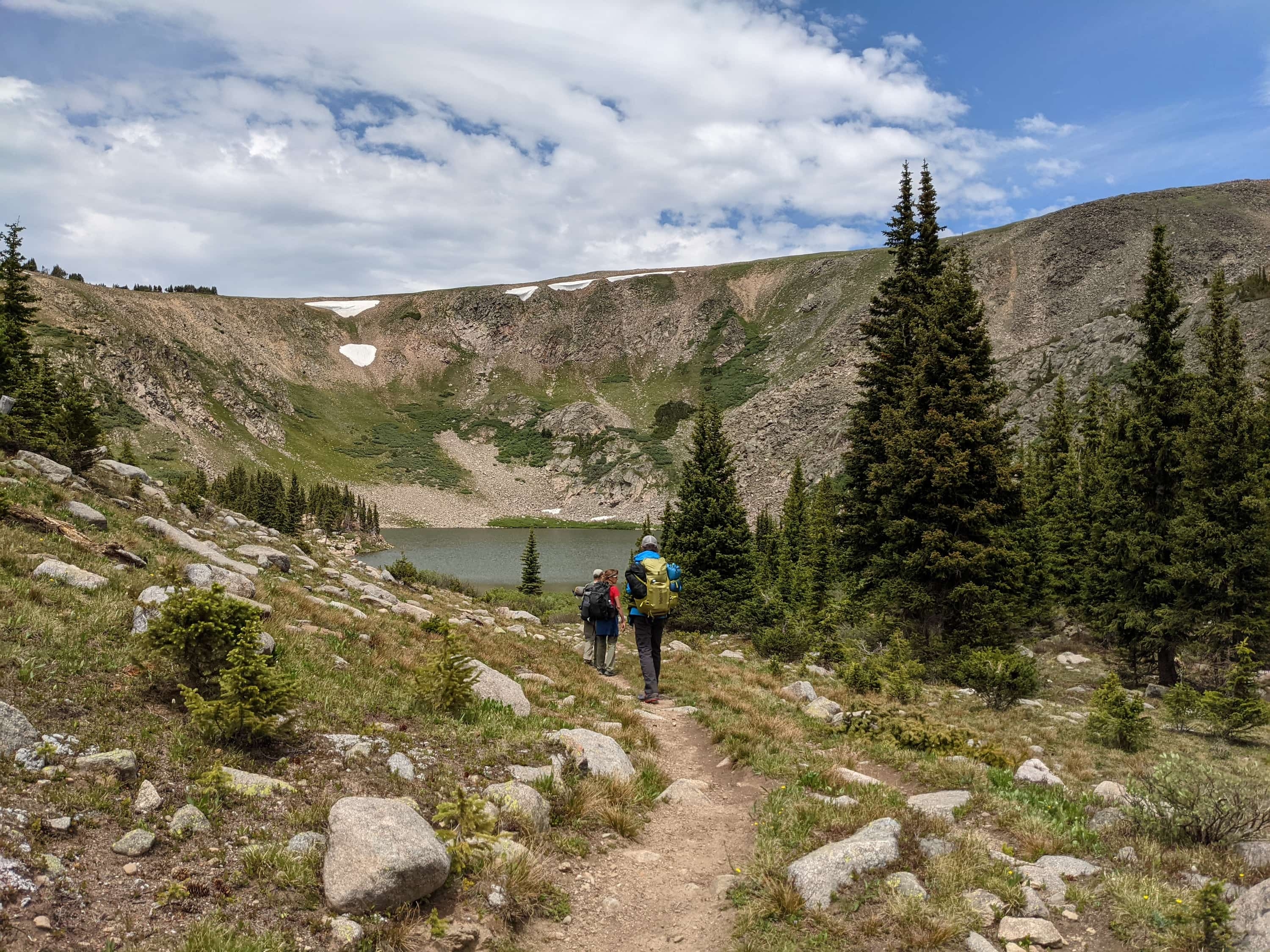
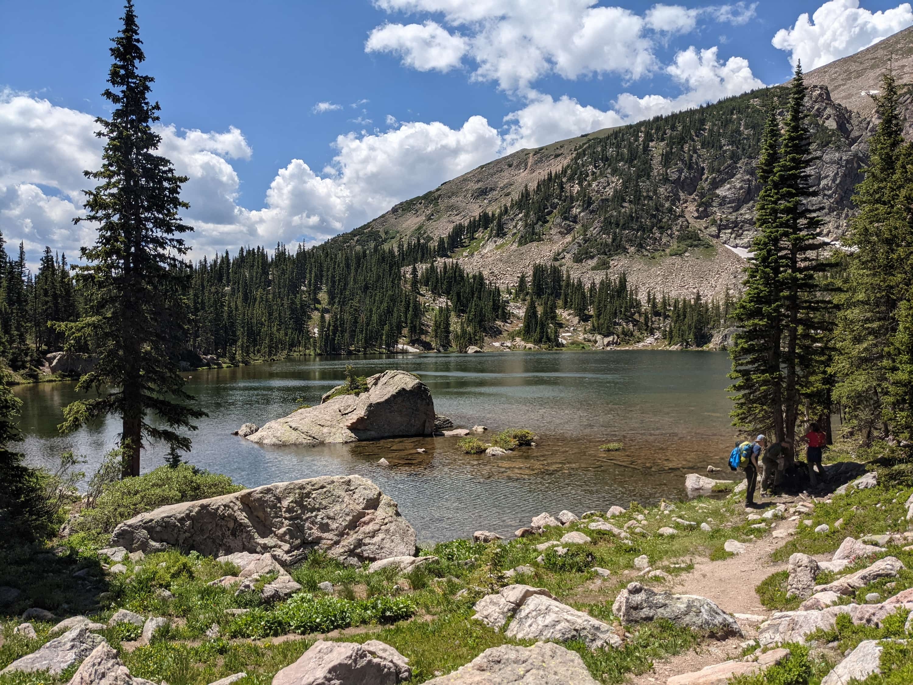
We started our hike at around 10:30 from the East Portal Trailhead near Moffat Tunnel. We didn't have much of an itinerary planned, but we figured we'd be flexible and find a nice campsite on the way. Luckily, less than an hour into the hike we met an older gentleman who gave us some great tips; he'd been going to James Peak for the past 30 years and recommended Heart Lake as a great place to camp. Heart Lake was about 3-4 mi away and in the direction that we were planning to go anyways, so we decided to follow his advice. I'm glad we did because the lake is gorgeous! It was a total of just under 5 mi of hiking with a little over 2,000 ft of elevation gain from the East Portal Trailhead. This trail is also listed as an out & back trail on AllTrails; I'd definitely recommend it.


The elevation gain, in addition to the fact that it was my first time carrying a heavy pack on a hike, really did me in! I embarrassingly ran out of breath easily despite already being acclimated to the elevation in Colorado. Though it was a tiring hike, it was all worth it as we were met with beautiful views of the South Boulder Creek, the Continental Divide, James Peak Lake and last but not least Heart Lake. We were also lucky to get a cloudless night, so we spent some time in the evening stargazing on our hammock (Alex's idea of course, being the star nerd that he is! 🤓). I was absolutely exhausted from the long day and ended up falling asleep after only 20 minutes of stargazing, but I still managed to see a shooting star!

Day 2: Continental Divide Trail to Corona Lake
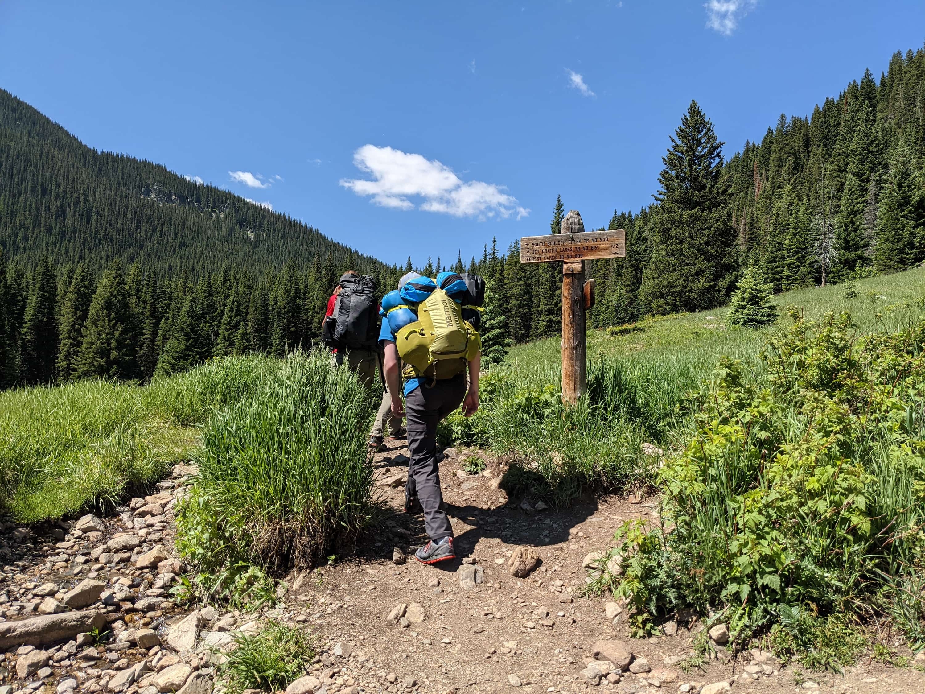
We got an early start the next day, leaving the campsite at 08:00. One thing we learned is that up in the mountains the weather can change quite drastically; though it may be sunny in the morning, you might still be greeted with thunderstorms in the afternoons. We wanted to make sure we avoided any afternoon thunderstorms, hence the early morning start.
From Heart Lake, we proceeded to go the rest of the way up the South Boulder Creek Tail until we got to the Continental Divide Trail. The hike was very, very steep! It was almost 800 ft of elevation gain over just 0.5 mi. Thankfully this was the hardest part of the hike so it felt great to get it over first thing in the morning.
The Continental Divide of the Americas
Before I go further, it's probably best to talk a bit about the Continental Divide (I honestly didn't know what it was, but I keep hearing about it throughout my time in Colorado). According to National Geographic, a continental divide is "a naturally occurring boundary or ridge separating a continent's river systems. ... Generally, precipitation that falls on one side of the divide will flow to one basin and precipitation that falls on the other side will flow to another basin." In the case of the Great Divide, rain that falls on these peaks will flow either to the east (eventually reaching the Atlantic Ocean), or to the west (eventually reaching the Pacific Ocean). In layman terms, it's a very tall mountain range that divides water.
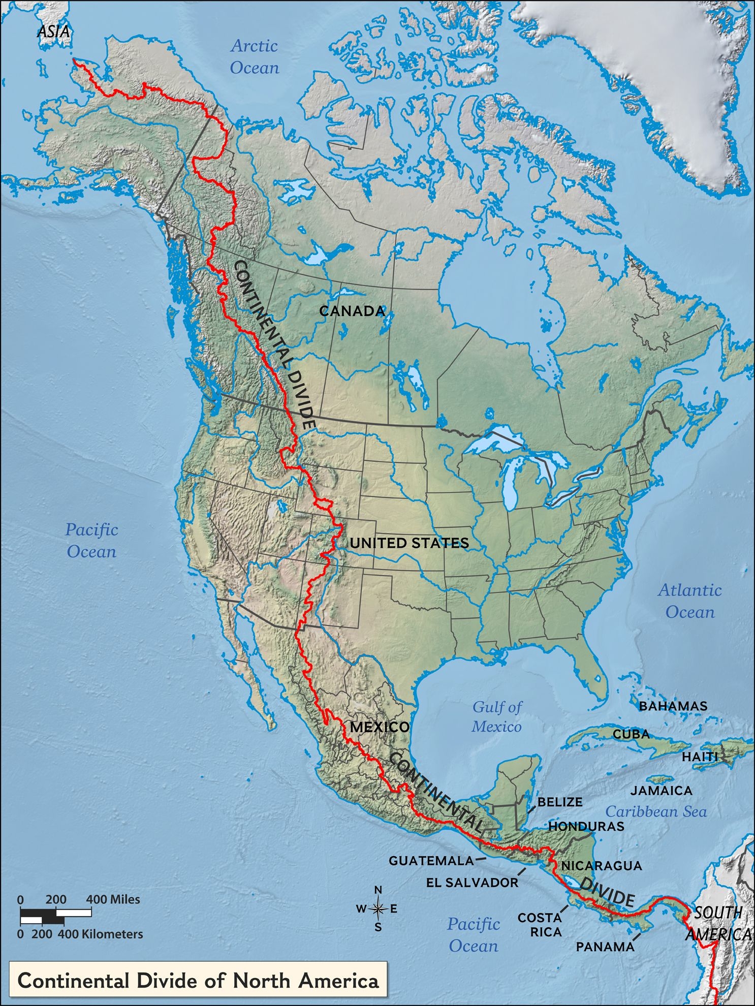
The continental divide that we were on is also known as the Continental Divide of the Americas or the Great Divide, as it runs through much of North and South America (all the way from Chile to Canada!). In the US in particular, you can hike the Continental Divide Trail, a 3,100 mi trail that follows the Great Divide through New Mexico, Colorado, Wyoming, Idaho, and Montana. It's an incredibly long trail and some people do actually hike the entire way. In fact, this is what a reviewer on AllTrails said:
If the desert and snow don't get you, the loneliness will.
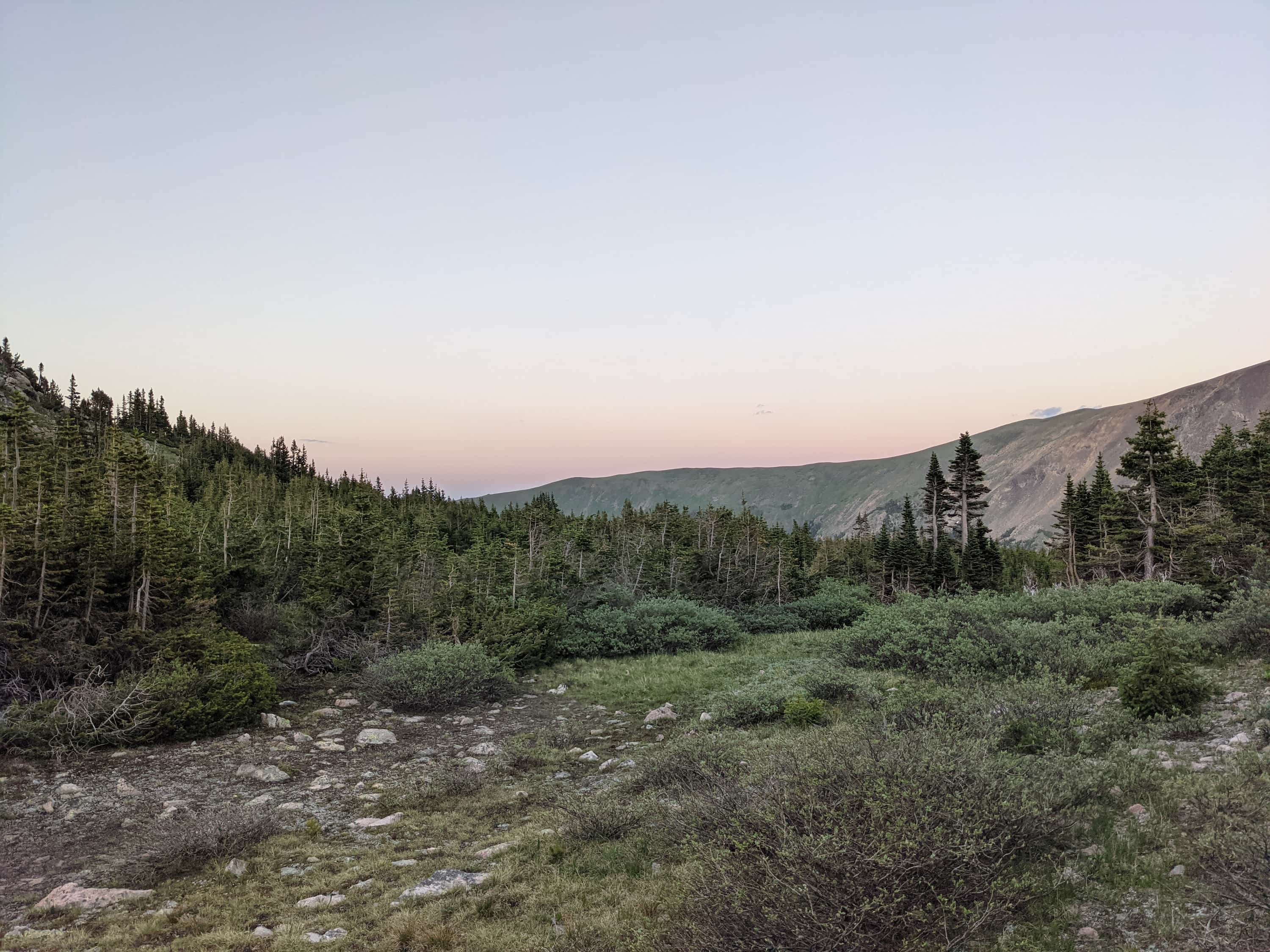
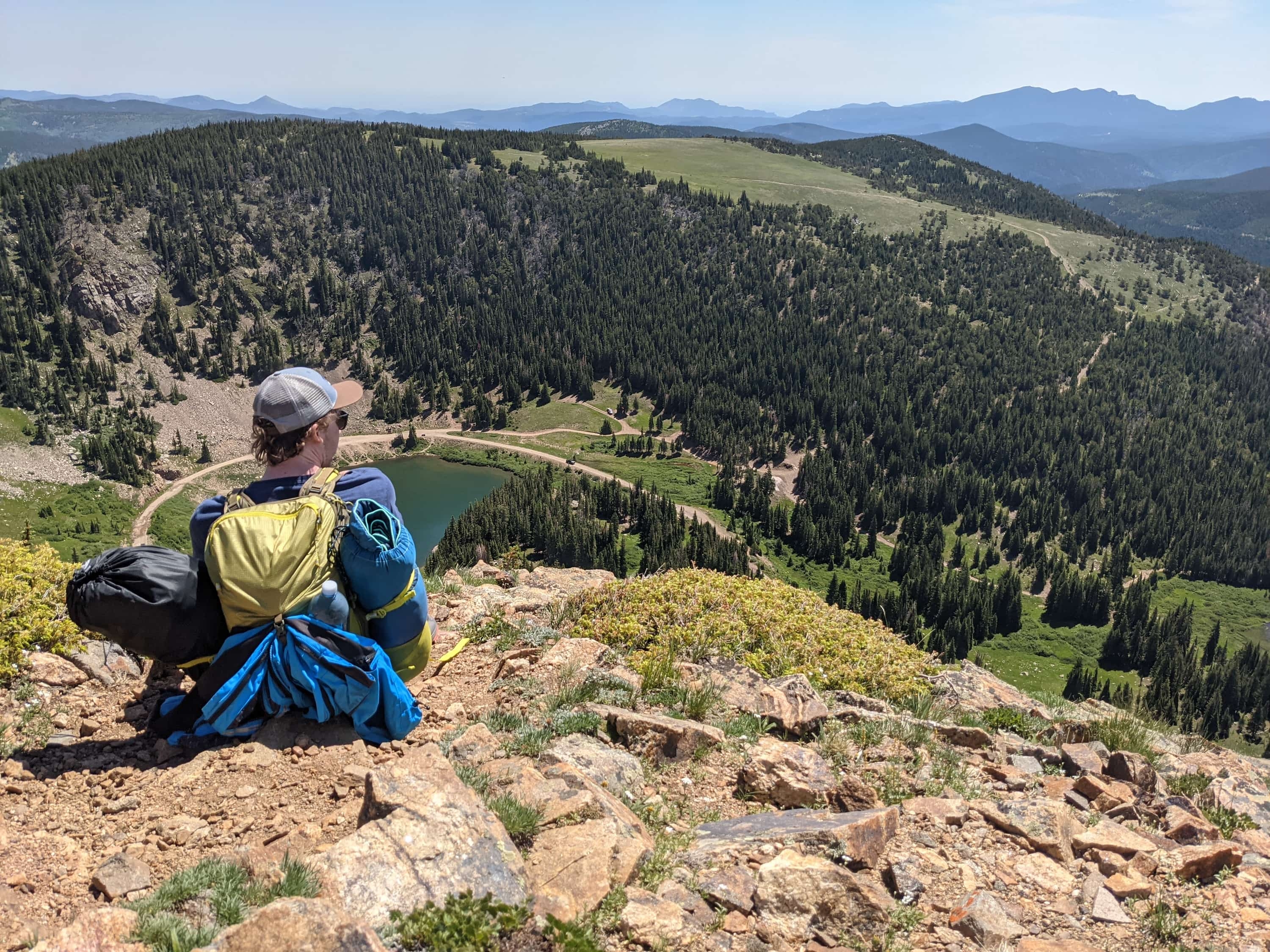
Of course, you don't have to hike the entire way to enjoy the beautiful views. For us, we decided to hike north about 5 mi on it all the way to Rollins Pass. On the way there, we were met with views of the Winter Park Ski area to our west, and a gorgeous view of James Peak Wilderness featuring its many (still half frozen) alpine lakes to our east. Though it was incredibly windy at the top, the views were definitely worth it!


Corona Lake
We decided to spend the night at Corona Lake, which is part of the James Peak Protection Area. I'm not really sure what the difference between a wilderness area and protection area is, but as far as I could tell, the two areas were both gorgeous and would be considered backcountry.
Corona Lake in particular wasn't as picturesque as Heart Lake, but still a nice place to camp. One thing I would note is that there was a surprisingly large concentration of mosquitoes in the areas, so if you plan on going there I'd recommend loading up on insect repellent. And to be honest, even with insect repellent, I still managed to get quite a few mosquito bites.
Day 3: Rollins Pass, Needle's Eye Tunnel, and Forest Lakes
On the last day of the trip, the task was simple: hike back to the East Portal Trailhead. However, it was definitely the longest (and strangest) hike out of all three days.
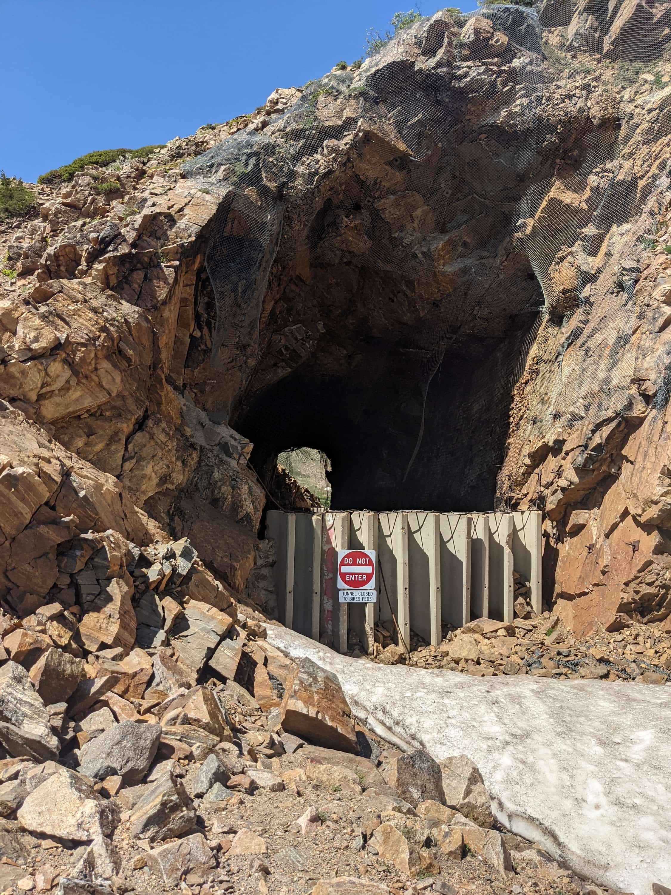
Our plan was to hike east along the historic Rollins Pass all the way back into James Peak Wilderness, but we quickly realized that this part of the pass was actually closed. We ended up following a path that looked like it went roughly in the direction we were aiming for, so we decided to follow it. It lead us to a closed tunnel, which we later found out is called the Needle's Eye Tunnel. The tunnel was closed in 1990 after a rock fell from the ceiling (rockfalls have been recorded as early as 1949), reopened, and then controversially closed again in 2008 (check out this website for a history of the tunnel).
Despite the fact that the tunnel was closed, we saw a lightly marked trail going over the tunnel. The trail was very steep, but between hiking over the tunnel and having to hike all the way back and around the Continental Divide, hiking over the tunnel seemed like a much faster approach.
Luckily, we made it over and across, and were able to continue our hike to the Forest Lakes Trailhead, which was our entryway back into the James Peak Wilderness. From the trailhead, it was a quick hike down to Forest Lakes where we decided to stop for lunch. Our last backpacking meal, yay!
From the Forest Lakes, it was 4 mi of (thankfully) downhill hiking back to the East Portal Trailhead. Two days of hiking had gotten me pretty tired, so I was excited to finally finish the trip. If anything, what this camping trip really proved to me was how addicted I am to boba tea. What kept me going for the last 4 mi back to the trailhead was the thought of having some boba tea that evening. 🤤🧋
Plan your hiking trip
- Continental Divide Trail — An interactive map to plan your hike
- AllTrails — A list of hikes in the James Peak Wilderness
- National Weather Service
- REI Co-op Half Dome SL 2+ Tent — Highly recommend this tent!
- James Peak Topographic Hiking Map — Very important!